Planning a trip to Cambridge and want to explore the beautiful area on foot? Here’s the best place to go walking in Cambridge this season…
Few English cities are better suited to a springtime walk than Cambridge. For somewhere with a such a weighty reputation — its realm of hushed college lawns and Gothic towers having been responsible for some of the planet’s greatest scientific breakthroughs — it’s a surprisingly small place. One of the advantages this brings to guests at YHA Cambridge is that everything feels within reach: you can take a 20-minute wander in one direction to arrive at the stone steps of the Fitzwilliam Museum, and a 20-minute wander in another to reach the green fringes of the city.

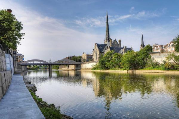
The route described here opts for the latter approach, heading west from the hostel to bring you to the open spaces of Lammas Land, Grantchester Meadows and the banks of the River Cam. This is a stretch of river popular with punting, a lazy-day pursuit which is these days synonymous with the city, despite its origins as a leisure activity only dating back to the early 1900s.
We may or may not be speaking from experience when we tell you that punt collisions and inadvertent, fully clothed wild swims occasionally occur, but you’ll have no such worries as you wind your way south along the riverside by foot. The well-to-do village of Grantchester — said to have the world’s highest concentration of Nobel Prize winners, thanks to its many resident academics — marks the rough halfway point of the route. Happily, it has a strong choice of pitstops, including gastropub The Rupert Brooke, country inn The Green Man and the 130-year-old Orchard Tea Garden.
Suitably refuelled, you’ll then head back into town, crossing the Cam at Brasley Bridge before joining the Guided Busway as it sweeps north into the city. The walk as a whole is just over six and a half miles, and essentially flat throughout, but you’ve got the option of covering the final couple of miles by bus if needed.
Once you’re close to the hostel, you can round things off by heading to the nearby (and brilliant) Cambridge University Botanic Garden, which is open until 5.00pm daily. If you’re looking for somewhere to immerse yourself in nature and relax, it’s just the place — particularly in its full spring finery.
YHA Cambridge Grantchester walking route
Essentials
- Distance: 6.7 miles (10.8km)
- Ascent: 21m (69ft)
- Time: Allow 2h 30m to 4h 15m
- Start/Finish: OS Locate TL 460 575
Directions
- From the hostel turn right onto Tenison Road. Turn left onto Lyndewode Road and left onto Glisson Road. Turn left onto Hills Road and right onto Bateman Street. Turn left and cross over Trumpington Road, then take the footpath on right, signposted Newnham and West Cambridge.
- Follow the brick wall and bear right at the junction. Follow the brook, bear left at the junction and cross the two bridges over the river.
- Immediately after the second bridge turn left along riverside path. At the small road (Grantchester Meadows) turn left. Bear left, then continue straight ahead and take footpath at end of road. Continue until sign for the Red Lion, then turn right onto High Street.
- Follow High Street around to the left which becomes Mill Way then Grantchester Road. Cross Brasley Bridge then turn right onto footpath, signposted Byron’s Pool.
- Turn left onto gravel path across Trumpington Meadows. Pass the school and car park and follow the cycle way under the Hauxton Road Bridge.
- Then either catch the bus on the guided busway — where the bus steers itself, or walk the 2.2 miles alongside the busway. Take care walking alongside the busway, buses travel at high speeds. From the train station cross the car park, head under the footbridge and turn left onto Devonshire Road back to YHA Cambridge. Watch out for cyclists throughout the route.
To download this route and view the many other walking routes from YHA hostels, see our self-guided-walks.
This route has been created by YHA to provide inspiration and to aid planning and preparation of your walk. It doesn’t replace the need for an OS Map or the OS Maps App to navigate your walk safely. Digital maps are a guide and do not always reflect the conditions on the ground, ensure you are aware of your immediate surroundings.
© Crown copyright and database rights 2020 Ordnance Survey 1000+99+5. For full terms and conditions please visit ordnancesurveyleisure.co.uk | Route: Matt Overd & Robert Priday
Discover more about YHA.


