Introduction
We know how important walking is on so many levels, from the wellbeing benefits to community spirit. But before heading out on a walk, some planning should definitely take place.
Walks in the countryside, on the coast or in upland areas can be challenging if you are unprepared, potentially resulting in injury. Take time to make sure you know what to expect and can deal with any eventuality. By putting in some planning time, it will ensure that not only do you have a clear route and timings worked out but some downtime to recharge and also appreciate the beauty around you.
Guidance for before you go
Things to check before you go
- Ensure you are wearing suitable clothing and footwear for the route and weather, and that you take the right kit.
- Check the local weather forecast and whether there is enough daylight to complete the walk. If you're venturing into the mountains, check the mountain weather forcast.
- When walking on the coast check local tide times.
- Download the OS Maps and what3words apps to your phone.
- Check you are able to contact emergency services by contacting 999 by SMS text. To use the service, you must pre-register by texting ‘register’ to 999.
- Complete a walking route notification card to provide essential information for the Emergency Services if you do not return when expected.
- Check all members of the group have the fitness and skills to complete the route.
- On city walks take care when crossing busy roads and look out for cyclists.
For more information on staying safe in the outdoors, visit adventuresmart.uk.
In case of emergency:
- Call 999 (or text 999 if pre-registered) and ask for the police.
- Use OS Locate or what3words to help pinpoint your location.
- To attract attention in the mountains shout or give six blasts on a whistle at regular intervals. In low light flash a torch six times at regular intervals.
- If you can send someone for help, they need to know your location, number of people in the group and the nature of the emergency.
Route notification card
Let others know where you're going
Walks in the countryside, on the coast or in upland areas can be challenging if you are unprepared, potentially resulting in injury. Take time to make sure you know what to expect and can deal with any eventuality.
Our route notification card is an important planning and safety tool. It is only used in the unlikely event you or your group get into difficulties and/or fail to return from your walk when anticipated.
Develop your walking skills
Understanding our walks
Grading our self-guided walking routes
Each one of our self-guided walking routes is graded to provide walkers with a clear and easy to understand assessment of the effort and skill required to undertake a particular walk and to compare one walk to another.
They are graded easy, moderate, challenging or severe. These can be very wide categories, so we have also graded each route numerically from 9 to 90 – the higher the grade, the harder the route. The grade is based on distance, overall ascent and terrain, plus how easy the route is to navigate, if it can be cut the short (if needed), any hazards along the way, how exposed to the elements you will be, and the impact poor weather could have on the walk.
Grades
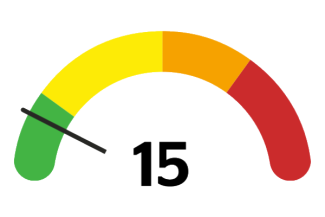
Easy (0-20)
Straightforward for most, taking about an hour or two. If there’s some ascent, the distance will be short. If it’s flat, the route will be longer.
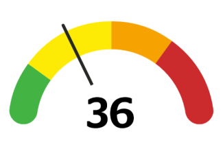
Moderate (20 to 50)
Longer than easier walks, requiring a morning or afternoon. More ascent, more uneven terrain and may require more navigation skills.
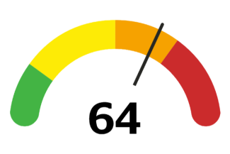
Challenging (50 to 70)
For walkers with more experience and higher levels of fitness, these routes are either long, challenging to walk or involve an ascent.
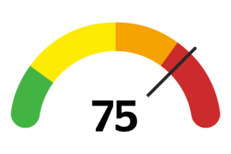
Severe (70+)
The hardest of all and best suited to experienced walkers. They are long or high, but probably both. Likely to be in remote mountainous areas.
Find out more about walking
Follow our routes on the OS app
Our self-guided routes are available to download from the OS Maps app along with thousands of other routes across Great Britain. You can download maps to your phone or print them off — so no phone signal, no problem.
